We left Seattle at 4am on Friday, and were booting up by 8am. After a very brief excursion along the wrong creek, we found the correct Silver Star Creek trail put in long ago by NOLS. After 500 feet up on good dirt trail, we hit continuous snow. 500 more feet later, and we crossed the creek and put on skis. The going was a little slow until we finally broke out into a swampy meadow and could see our objective. We were now able to map out our course much more easily.
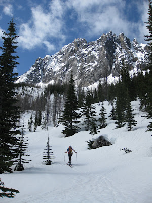
Heading up the trail:
Skinning up from the meadow toward Vasiliki Ridge:
Climbing just below Vasiliki Ridge, the sun really started to heat things up. We saw a few small cornices break off the ridgetop, sending small wet slides down towards our path. As we neared an open bench one larger one came down, but we were able to avoid it as it was moving quite slow. Had it hit us, it would have been annoying, but not devastating. Once at the large open bench we stopped for a bite to eat and discussed our route options. There were three couloirs leading up toward the Silver Star Glacier. The route description said to take the one on the left, but from what we could see it didn't look good, and the bootpack led up the rightmost couloir. We decided to follow the bootpack. It was steep going, but we eventually reached the small cirque just below Burgundy Col.
Nearing the top of the right-most couloir:
Burgundy Spire:
Burgundy Spire:
Once passing under Burgundy Spire, we reached a little col and dropped onto the Silver Star Glacier. We noticed that if we were to return the same way, we'd have a significant climb back up to go down the way we came. We also would have had to traverse a lot to go down the same couloir to the meadow. We had spotted some old ski tracks from the meadow on the opposite side of the valley. Now we were able to see that if we skied down the opposite side of the glacier, we'd be able to link up and greatly decrease our traverse. The loop had much more appeal. We made quick work of the glacier and tackled the final headwall to the col. Once there we rested for a while and transitioned from skis to crampons for the final summit block.
Resting at the col:
Gilbert works his way up to the summit from the col:
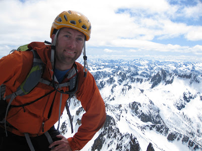
Summit shot:
The Liberty Group from the summit:
We dropped back down to the col and transitioned back to skis. The skiing on the way down was surprisingly good! We had creamy corn until reaching the meadow, then the expected combat-skiing through tight trees for another 500 feet before we took the skis off. We set off a few really small wet slides, but overall the snowpack was really stable. While it took us 6.5 hours to climb 5500 feet from the car to the summit, the 4000 foot ski down took about 40 minutes at a leisurely pace. Gotta love ski mountaineering!
Gilbert shreds the upper headwall:
Me scoping out my line down the opposite side of the glacier:
Enjoying the fruits of my labor:
A parting look at our skin track up the couloir to Burgundy Col:
We ended up carrying skis down about 500 vertical feet of snowy terrain at the end, because the terrain was just to tight the the tree wells were fierce. All told, we spent a total of 9.5 hours out, car to car. By the time we reached the car, we were both feeling royally scorched by the relentless sun and glare from the day. Tough to complain too much about that! I fueled up for the long trip home by hitting the "Good Food" drive-in in Marblemount, which really hit the spot.
I've wanted to climb Silver Star for a while. I'm really glad I waited to be able to do it on skis in this way. I don't know why anyone would do it on foot, given the option. It is a fantastic ski. I had a great day in the mountains with a great partner. I have a feeling I'll do this one again someday. Until next time!


No comments:
Post a Comment